
Geospatial Analysis
We work with federal and state agencies to determine the feasibility of installing energy projects on public land.

Right-of-Way (ROW) is the public roadside land that you’ve likely been staring at on road trips your whole life. It’s a general term referring to land, property, or interest acquired for or devoted to transportation infrastructure.
The Ray offers public agencies advanced geospatial analysis tools to evaluate ROW corridors for transmission and energy distribution projects, visualizing the infrastructure using 3D modeling on the most suitable land.

ROW Transmission Analysis Tool
Streamline the complex process of siting new transmission lines with our ROW Transmission Analysis Tool. This powerful solution uses a smart, weighted scoring system to evaluate multiple infrastructure and environmental factors, including railroads, pipelines, and water features, to find the most suitable locations for new lines.
Our tool offers flexible weighting, allowing you to adjust criteria based on project needs. It also integrates key data, like state transportation plans, and analyzes routes for both overhead and underground infrastructure. Get optimal routing paths, estimated vegetation clearing, and rough cost projections to make informed decisions and save time and resources.
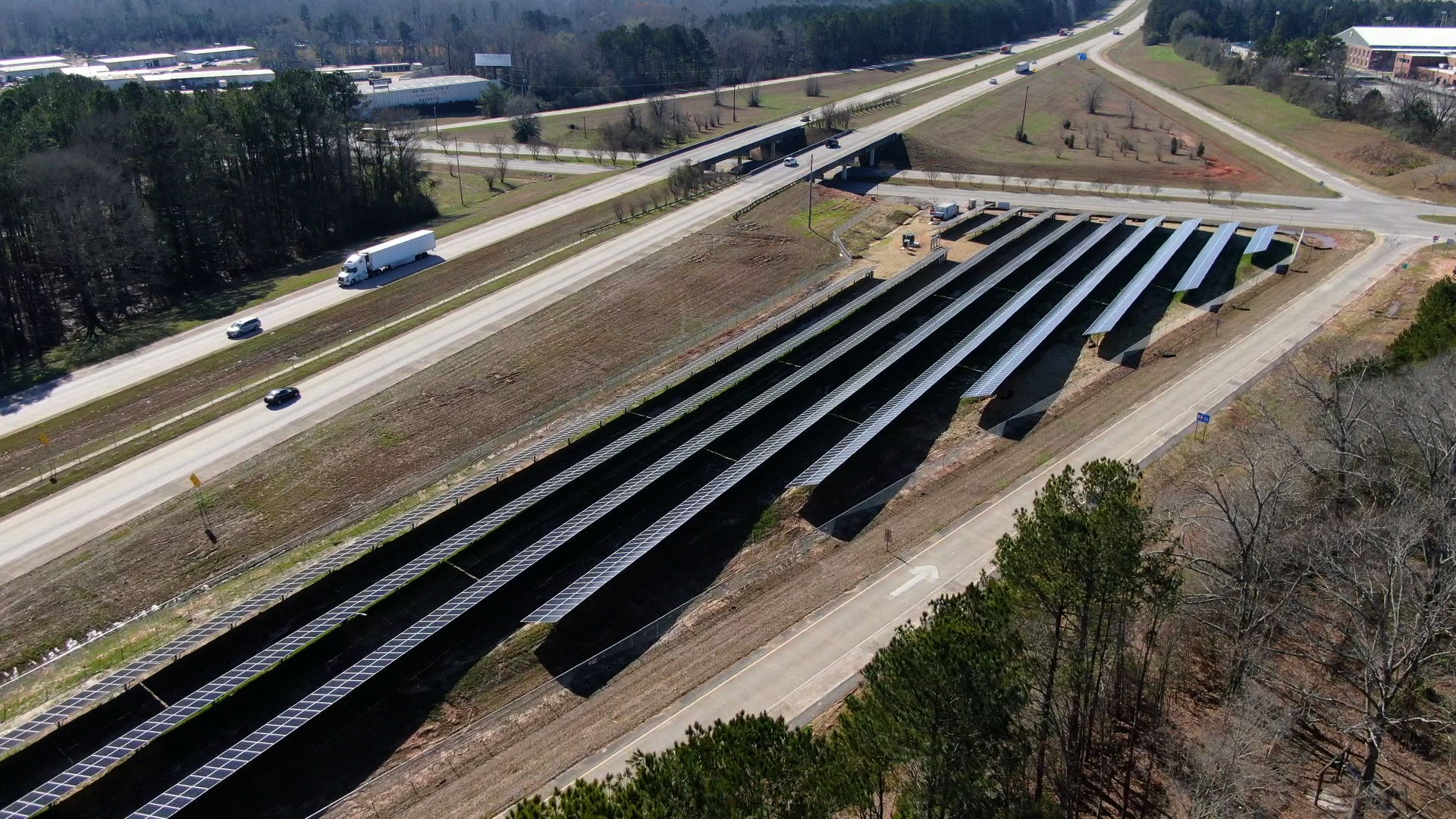
ROW Solar Mapping Tool
Harness the power of your ROW assets with our innovative Solar Mapping Tool to quickly identify and evaluate the economic potential of energy development. By leveraging advanced data and 3D modeling, our tool streamlines the planning process, providing precise configurations for solar arrays and generating key insights into energy production, financial viability, and environmental impact. Combining this technology with our expert analysis accelerates the deployment of diverse energy projects, helping agencies unlock new revenue streams.

Natural Capital Tool
Maximize the value of your highway corridors with our Natural Capital Tool. It transforms medians into resilient, eco-friendly assets that enhance both infrastructure and biodiversity. The tool uses a two-phase intelligent site selection process to identify optimal wildflower planting locations. First, it eliminates unsuitable areas based on safety and operational constraints. Then, it assesses the remaining sites for slope, solar radiation, and existing plant health to ensure successful wildflower establishment. By balancing transportation needs with environmental goals, our tool helps transportation agencies create stable, beautiful, and biodiverse corridors.

Rubber-Modified Asphalt (RMA) Tool
Addressing the threat of urban heat islands is crucial for creating safer and cooler cities. Our innovative tool utilizes advanced analytics and data from remote sensing, census, and other sources to pinpoint the most at-risk communities. We identify where RMA has the most significant impact as a robust, data-driven solution. Rubber asphalt absorbs less heat and lowers CO2 emissions, directly mitigating heat-related risks. Our targeted approach helps you prioritize repaving projects to build cooler, more resilient urban environments.
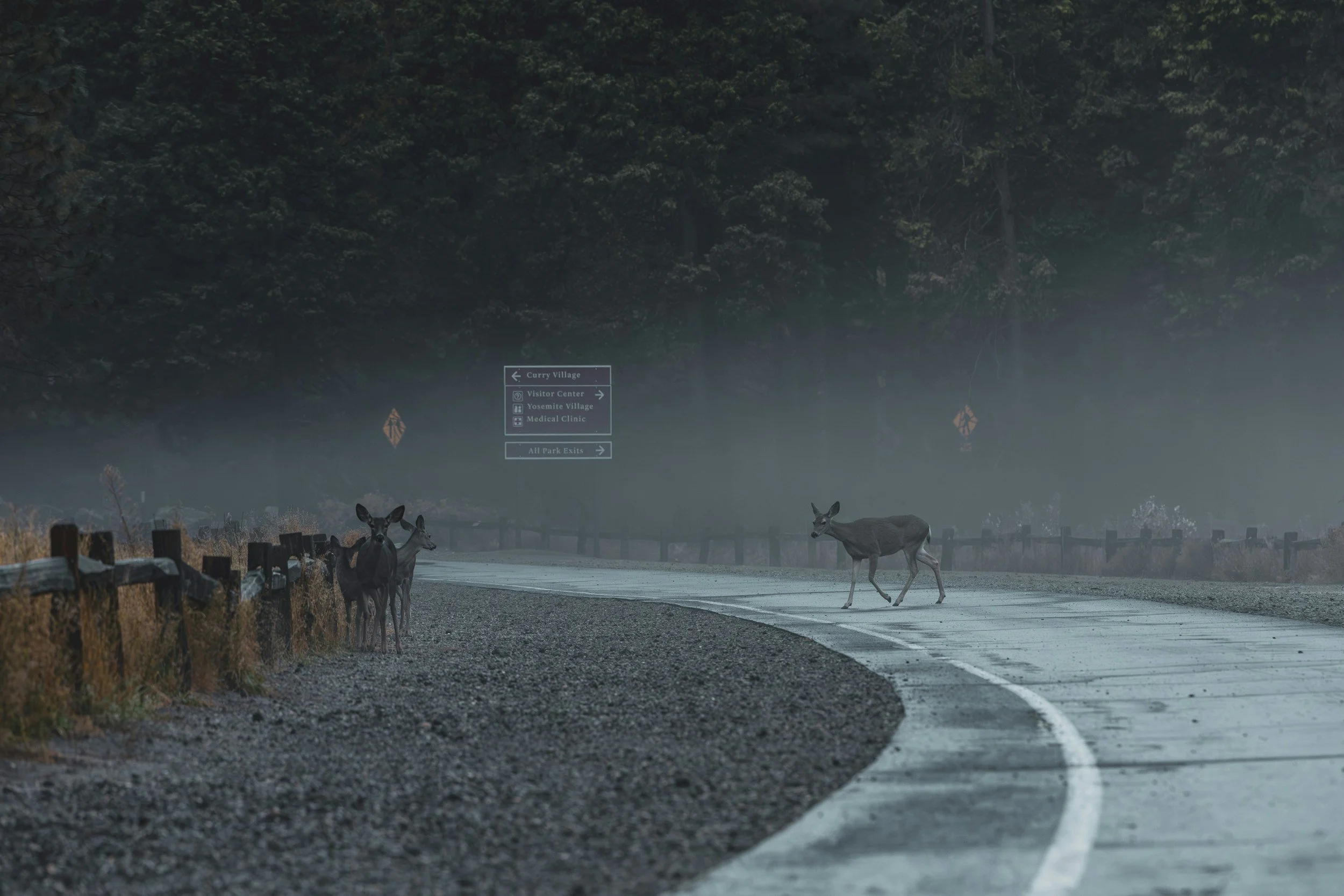
Wildlife Crossing Tool
The Wildlife Crossing Tool is an innovative solution designed to boost safety for both motorists and wildlife. By using data to pinpoint the best locations for wildlife crossings, this tool helps reduce collisions, ensuring safer roads and a more connected ecosystem. A pilot program, our ongoing research aims to refine the tool and expand its capabilities to further protect both people and animals.
Esri Partnership
Developed in partnership with Esri, the global leader in location intelligence, our powerful geospatial tools were designed with in-house expertise to drive energy and infrastructure innovation to meet future demand and reliance with private sector know-how.